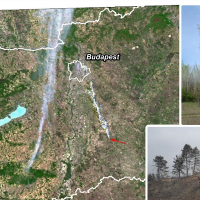
Wildfire poses a serious risk in several regions of the world threatening urban, and agricultural areas, and natural ecosystems as well. Nature conservation has an important role in being prepared for the management of postfire environmental degradation and restoration for protected areas preserving valuable ecosystems. The improving temporal and spatial resolution of remote sensing and GIS methods significantly contributes to mapping the changes for accelerating management steps of restoration. In this study a severe wildfire and its impacts were assessed in case of a protected area of the Kiskunság National Park in Hungary, which was partly burnt down in 2012. The aim of this research was to efficiently and accurately assess the damages and to plan and execute the restoration works using remote sensing tools. Aerial data collection was performed one month, and one year after the fire. In 2014 the regenerated vegetation was surveyed and mapped in the field. Using the aerial photographs and the field data, the degree and extent of the fire damages, the types and the state of the vegetation and the presence and proportion of the invasive species were determined. Semi-automatic methods were used for the classification of completely, partially damaged and undamaged areas. Based on the results, the reforestation of the burnt area is suggested to prevent the overspreading of white poplar against common junipers and to clean the area from the most frequent invasive species. To monitor the regeneration of the vegetation and the spreading of the invasive species, further aerial photography and field campaigns are planned.
